LTN-101 FLAGSHIP™ GNADIRU

commercial aircraft in air with insert of inertial reference unit

LTN-101 FLAGSHIP™ meets or exceeds FAA navigation, attitude, heading and air data accuracy requirements.

The LTN-101FLAGSHIP™ is an integrated global navigation, air data, inertial reference unit (GNADIRU) that has redefined industry standards for laser inertial navigation systems.

Introduced in 1992, FLAGSHIP™ has established an exceptional reliability on such commercial aircraft as the Airbus wide and narrow body families, Canadair Regional Jet, CL604, and the Saab 2000.
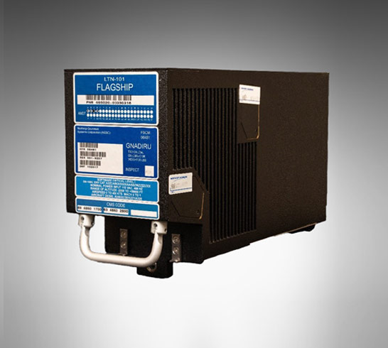
inertial reference unit

LTN-101 Services

  • Northrop Grumman offers for sale serviceable spare units and parts
  • Unit overhaul & repair
  • Subassembly overhaul & repair
  • Software updates, including MagVar updates
  • In-field operations for software updates
  • Advanced exchanges
  • Aircraft on ground support 24 hours a day 365 days a year

LTN-101 System Performance

  • Accuracy
    • <2.0 NMI/HR, 95%, CEP pure inertial2.0
  • Reliability
    • >16,000 operating hours MTBF

LTN-101 Technology

Performance and reliability of the FLAGSHIP™ is based on a series of design innovations:

  • Four Mode Laser Gyro (FLAG)
  • Software/Hardware Implemented Partitioning (SHIP)
  • Fault containment

FLAGSHIP™ Lowers Ownership Costs Through:

  • Increased functionality and flexibility
    • Integrated GPS and air data
    • ARINC704/738/743 compatible without modification
  • Proven reliability
    • Exceptional Mean Time Between Failure (MTBF) reliability record
    • Minimal false removals
  • Enhanced maintainability
    • Advanced built-in test to Level II
    • In-flight fault diagnostics
    • System and module BIT history storage

Four Mode Laser Gyro (FLAG)

The patented FLAG combines three 18 cm Zero-lock™ Laser Gyroscopes in a single cavity. Undithered and 40-percent smaller than conventional ring laser gyros, FLAG means long gyro life, high accuracy and reliability, and reduced costs.

Software/Hardware Implemented Partitioning (SHIP)

SHIP organizes major system functions such as GPS, inertial reference, and air data in modules, ranks them by criticality, and isolates them from all other modules in both execution and memory access. This approach eliminates corruption of one function by another and contains functional loss due to a fault.

Fault Containment

Fault containment ensures minimal functional loss in the event of a fault by prohibiting its propagation throughout the system.

Family of Inertial Measurement Units (IMU) and Navigators

fleet of ships on water

Assured Positioning, Navigation and Timing (PNT)

two-axis gyroscope next to penny

G-2000 Gyroscope Inertial Product Family

military helicopter in flight

LN-200 FOG Family Advanced Airborne IMU/AHRS

LN-200S Inertial Measurement Unit

LN-200S and LN-200HPS Inertial Measurement Units

Two E-2D Advanced Hawkeye aircrafr inflight

LN-251 Advanced Airborne INS/GPS (EGI)

military jet in sky with callout of global positioning system unit

LN-260 Advanced Embedded INS/GPS (EGI)

Three-dimensional, multi-mode, gallium nitride land radar displayed on grass

LN-270 Pointing, Locating, Navigation and Stabilization System INS/GPS (EGI)

satellite hovering over earth

LR-450 Inertial Measurement Unit (IMU)

inertial reference unit

LR-500 Quad Mass Gyro (QMG) Inertial Measurement Unit

photo of gyro sensor overlayed on globe and space image

Scalable Space Inertial Reference Unit (SSIRU™) Family of Products

Contact Us

Service and Support
1-866-NGNAVSYS (646-2879)